Cow Parlour
origins
There are lots of Cow Parlours around the place, and they are just that: dairy and milking areas.
Weavers
However, it is claimed that this Cow Parlour is actually a corruption, or phonetic equivalent, of a term in use by Huguenot weavers who had a strong presence in this area.
Adrian McLoughlin, in his Guide to Historic Dublin, suggests coupeurs d'ourlets which translates as hem cutters and a possible variation coupe ourlet which would be a hem section.
While I would not contest the origins of this cow parlour being in the weaving trade, the precise term referred to does not ring true with me. When these terms are lifted they are usually phonetically very close to the original. Examples that spring to mind are the Avocado Pear (Ahuacatl/avocado) and the London Underground station Elephant and Castle, which is supposed to have come from the Spanish, El Enfante de Castille.
Cathy Scuffil, in her paper on Dublin placenames, favours coupeur, implying the longer term coupeur d'ourlet and this would make more sense to me. Failing that, my own candidate for our cow parlour would be coupeurs/ourleurs translating into cutters/hemmers and giving a phonetically closer fit. So far I have not been able to determine if this precise formulation was in use in the weaving trade in Dublin.
Meanwhile, Ciar�n MacGonigal, in the Irish Times of 1/5/1993 suggests that it derives from Qui Parlez the old password in that part of French-Huguenot Dublin. Rocque's map of 1757 might lend some support here as he has the version cow parler. So it's still an open question and I'll keep an eye out for this one along the way and report back.
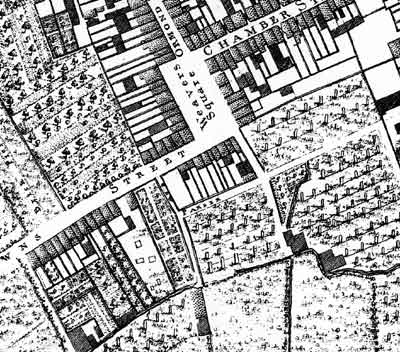
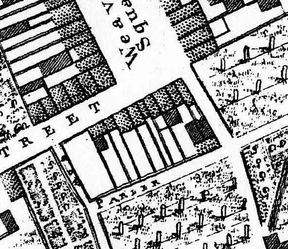
The map above shows the northmost part of the Tenters Fields at bottom right, Weavers Square at top middle and Cow Parler in the middle of the picture. The detail below isolates Cow Parler which can be seen to be a series of premises possibly resembling those on Weavers Square proper.
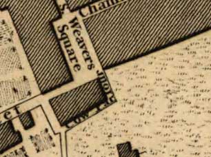
This plan from 1797 seems to endorse the same area as Cow Parlour as in Rocque's map.
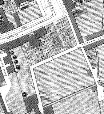
The map above shows the same area some 50 years later. The connection through to Brown Street is gone as are many of the buildings just south of Weaver's Square. The place seems to have gotten quite a makeover. This would not be surprising as the weavers trade had all but died out in the intervening years.